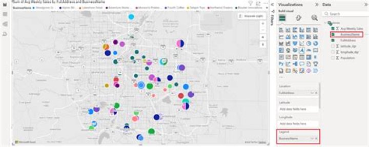
I have a list of cities that I'm plotting on a map in Power BI. The client asked if there is anything we can do to reduce the bubble sizes, but I already have them set to 1%. Even cities with only 1 or 2 records show up at a pretty large bubble size. In the image below you can see a value of 2 is similarly sized to values as high as 2000. Any ideas on how to deal with this?
1 Answer
@aGuy It looks like there are significant variations in the sizes of bubbles on the map already (e.g., larger bubbles over Los Angeles & @ southern tip of FL).
If the bubble sizes are such that one can't see a difference between 2 & 2000 calls, maybe adding a calculated column that describes call ranges (e.g., low (0-2000), medium (2001-10,000), & high (> 10,001) & using the new calculated column as a legend on the visual will help the client differentiate b/t these groups?